Why can’t I see an aircraft?
- Disaster Science
- Bushfire.io
- January 16, 2023
Table of Contents
Please see our main article here.
Please see our main article here.
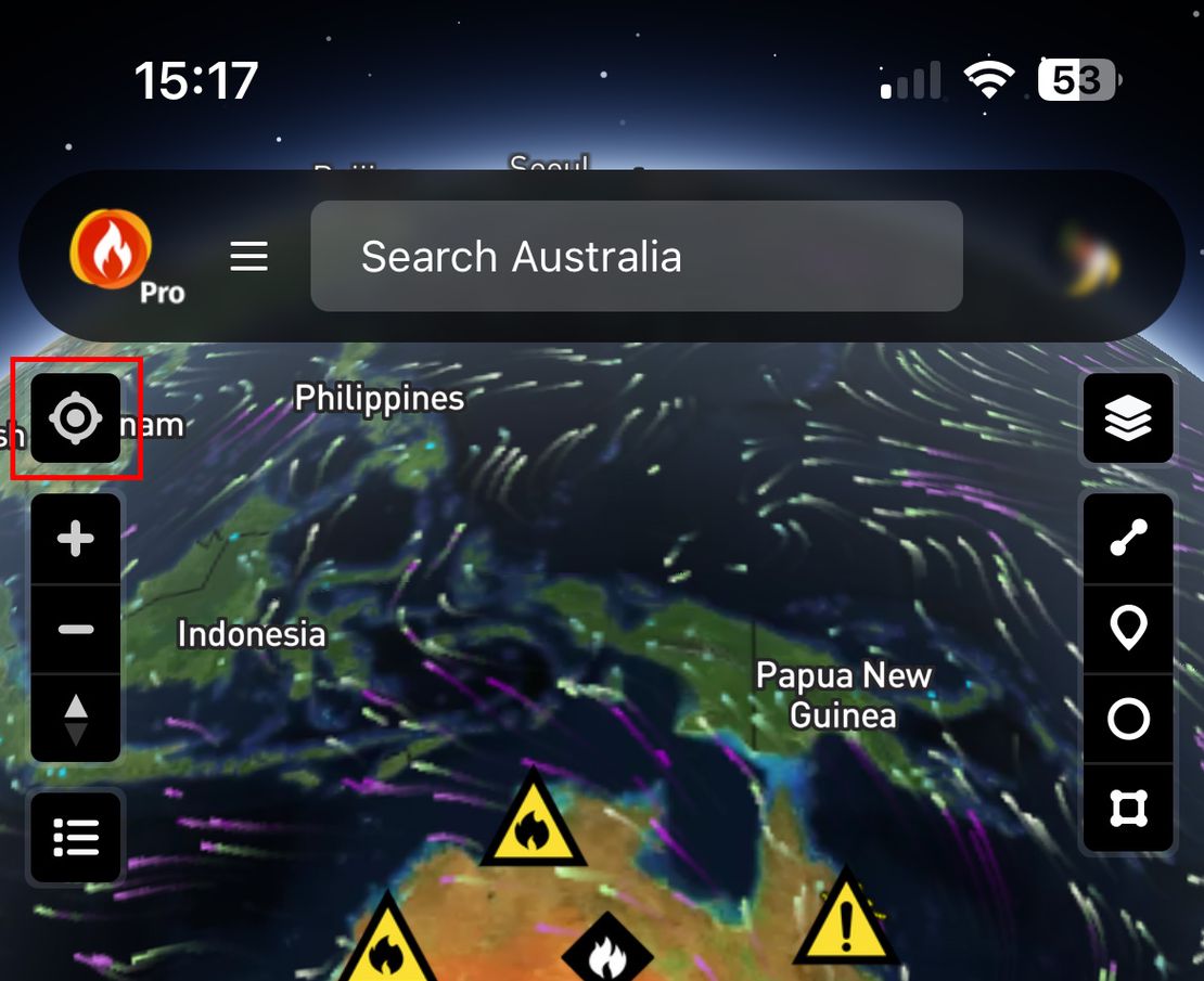
You may notice your device may not have been located to where it is in the real-world
Read More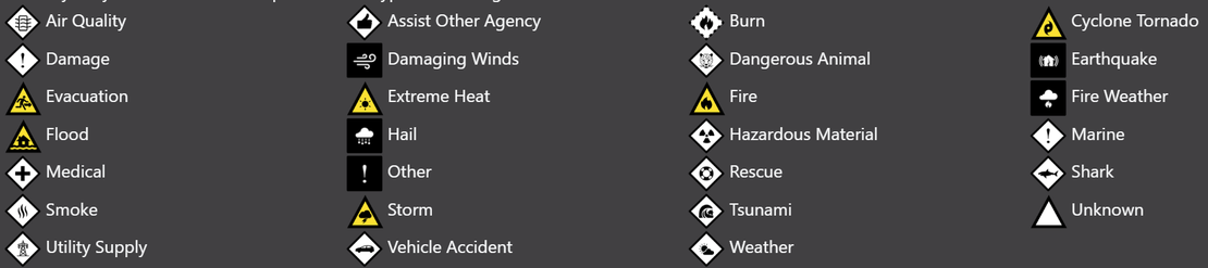
While we have attempted to make the symbols, icons and colours as intuitive as possible, there can be a lot to interpret.
Read More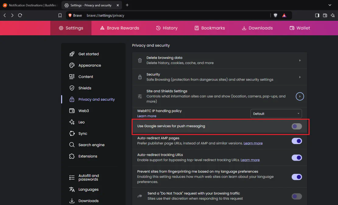
Common Problems “I am having trouble enabling location or notification permissions” “I’ve recently updated my Android device, and I cannot receive notifications.” Bushfire.io on Android If you’re experiencing issues enabling notifications (e.g., you don’t get any notifications at all, or you cannot enable notifications), then it’s worth checking the Bushfire.io App has permissions.
Read More