How do I share a layer with my team?
- Disaster Science
- Bushfire.io enterprise
- November 4, 2026
Table of Contents
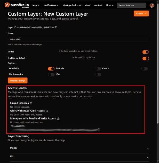
Only you can see a new custom layer. While a layer is not shared, its page shows Only you can see this layer. Share the layer so that your team can see your sites on the map.
Info
Requires a subscription to Bushfire.io Business or Enterprise. Part of the Enterprise Admin Guide.
Ways to share
| Method | Who gets access | Access level |
|---|---|---|
| Linked Licences (recommended) | Every person on the licence | Pro: read-only. Business and Enterprise: read and write. |
| Users with Read-Only Access | One person | Read-only |
| Managers with Read and Write Access | One person | Read and write |
A linked licence is easier to manage. New people on the licence get access automatically. People that you remove from the licence lose access automatically.
Link a licence
- Go to My Organisation > Layers.
- Select your layer.
- Select Layer Settings.
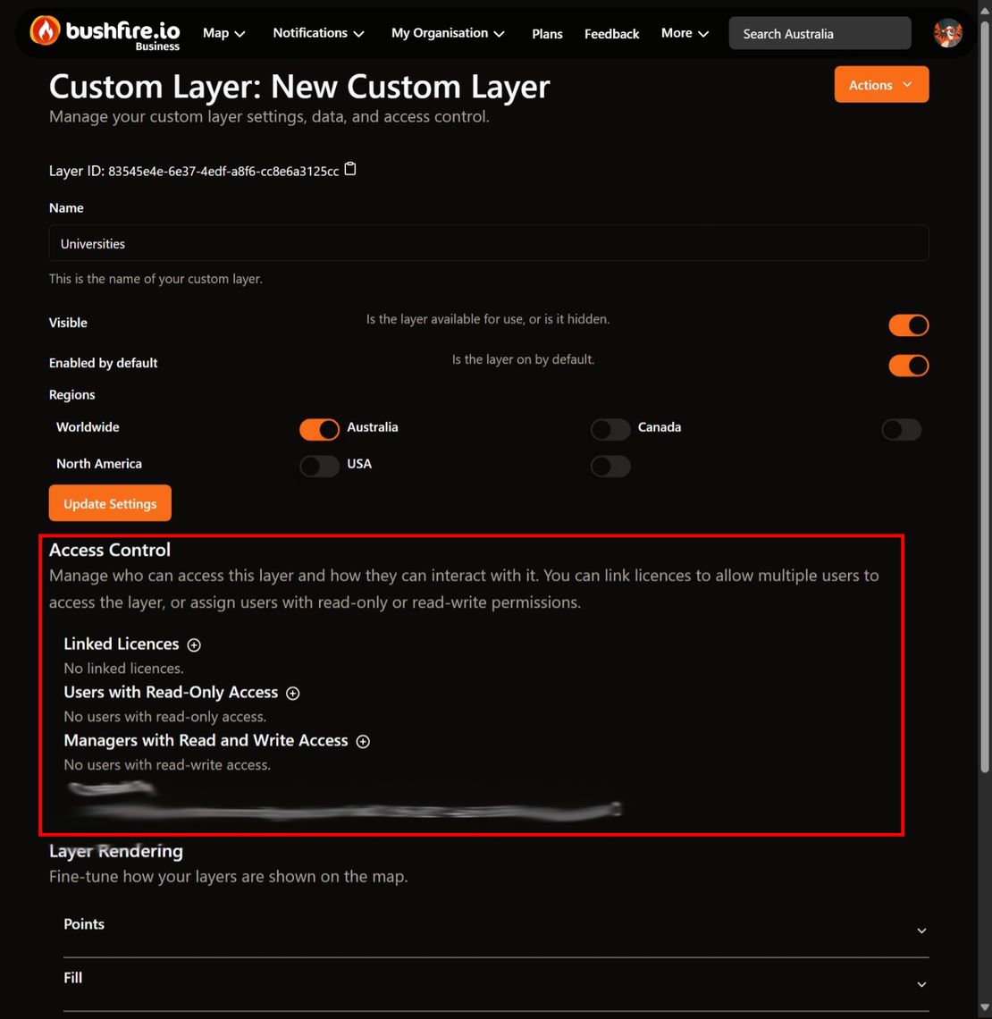
- Under Access Control, select the ➕ button beside Linked Licences.
- Select the licence from the list.
- Select Add Licence.
The app shows Licence added.
Add one person
- Open Layer Settings for your layer.
- Under Access Control, select the ➕ button beside Users with Read-Only Access or Managers with Read and Write Access.
- Select the person from the list of your organisation users.
- Select Find to add them.
To remove access, select Remove beside the licence or the person. There is no confirmation.
Choose how the layer shows on the map
In Layer Settings, these options control the layer for everyone with access:
- Visible: when this is off, the layer is hidden from the map.
- Enabled by default: when this is on, the layer is turned on when a person opens the map.
- Regions: the regions where the layer is available, for example Australia.
- Sort order: layers with lower numbers show first in lists, and under other custom layers on the map.
Select Update Settings to save.
Good to know
- A person with a User licence cannot see custom layers. Give them a Pro, Business or Enterprise licence.
- People with read and write access can add, change and delete sites. They can also set up layer alerts.
- To see the layer, your team opens the main map and turns the layer on in the Layer Control.