How do I add a site?
- Disaster Science
- Bushfire.io enterprise
- November 4, 2026
Table of Contents
A site is a place that you want to watch, such as an office, a depot or a property. You add sites to a custom layer. Your team can then see the sites on the map and get alerts when an event is near them. The app calls sites “points of interest” or “features”.
Info
Requires a subscription to Bushfire.io Business or Enterprise. Part of the Enterprise Admin Guide.
1. Create a custom layer (first time only)
If you already have a custom layer for your sites, go to step 2.
- Go to My Organisation > Layers.
- Select the ➕ button, or select Actions > Create a New Custom Layer. The app creates a layer called New Custom Layer.
- Select Layer Settings.
- Change the Name, for example “Depots”.
- Select Update Settings.
Only you can see a new layer. To share it, see How do I share a layer?
2. Draw the site
- Go to My Organisation > Layers.
- Select your layer.
- Select Launch Map Editor.
- Zoom in to the site.
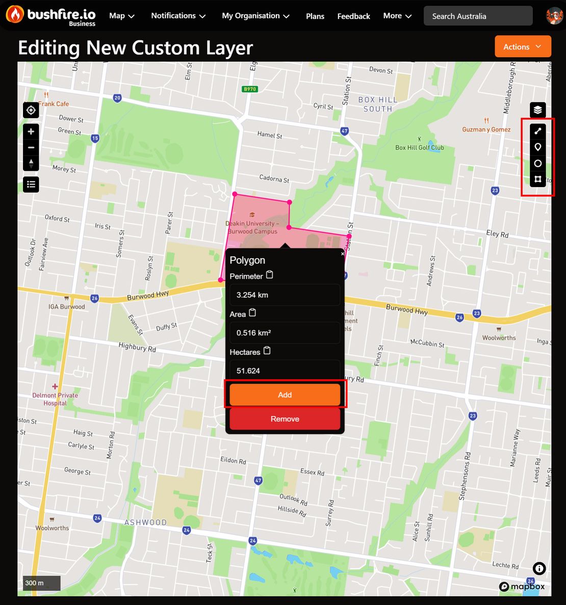
- From the tools on the right, select the shape:
- Point: one location, such as a building.
- Circle: a location with an area around it. Touch, hold and drag out.
- Polygon: an area, such as a property boundary. Touch the first point again to finish.
- Line: a route, such as a pipeline or a road. Select the last point again to finish.
- Select the shape that you drew.
- Select Add. The app saves the shape and opens the Map Feature panel.
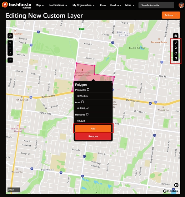
3. Name the site
- In Title, enter the name of the site. Your team sees this name on the map.
- In Body, enter more detail, for example an address or a contact phone number.
- Select Save.
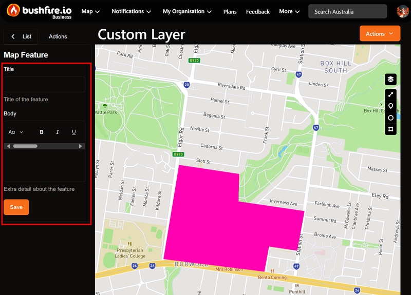
The site is now on your layer. To get alerts near it, see How do I get alerts near my sites?
Change or delete a site
- To change the title or body, select the site in the list on the left of the Map Editor. Make your changes. Then select Save.
- To delete a site, select it. Then select Actions > Delete.
- You cannot move a site or change its shape. Delete the site. Then draw it again.
You can also open a site from the main map. Select the site, then select Actions > Edit.
Warning
Delete has no confirmation. The app deletes the site immediately.
Add many sites at once
If you have a list of sites in a GIS or a spreadsheet, you can add them as GeoJSON.
- Export your sites as a GeoJSON FeatureCollection.
- Give each feature a
titleproperty and abodyproperty. - Open your layer.
- Select Layer Settings.
- Go to Points of Interest.
- Copy the current GeoJSON from the editor, and keep it as a backup.
- Add your features to the
featureslist in the editor.
Warning
The Points of Interest editor saves as you type. There is no Save button. Each change that is valid GeoJSON replaces all of the sites on the layer immediately. If you paste over the text, the sites that you drew in the Map Editor are deleted.
The map shows the body as HTML, so you can use simple HTML such as links and bold text. Other properties do not show on the map.
Contact us if you have a large number of sites, or sites that change often. We can help you add them with our API.