Disaster Science Introduces Possible Fire Ignitions
Automated fire ignition detection with lightning, satellite hotspots, machine learning, and advanced analytics.
February 26, 2025 Canberra, Australia
We’re proud to unveil Possible Fire Ignitions, a new tool harnessing lightning data and satellite-detected hotspots—all supercharged by machine learning and advanced analysis. Now available in Bushfire.io Pro, this feature provides an early-warning capability to help spot emerging fires before they spread.
A Universal Challenge, A Breakthrough Solution
Lightning strikes are widely acknowledged as a key ignition source for large-scale fires. Historically, response teams and communities have relied on either lightning data or satellite imagery alone—each having blind spots that can delay detection. With Possible Fire Ignitions, we merge these two critical datasets (alongside additional intelligence) into a single, near-real-time system, enabling faster, more accurate, and more targeted responses.
Less Guesswork, More Insights
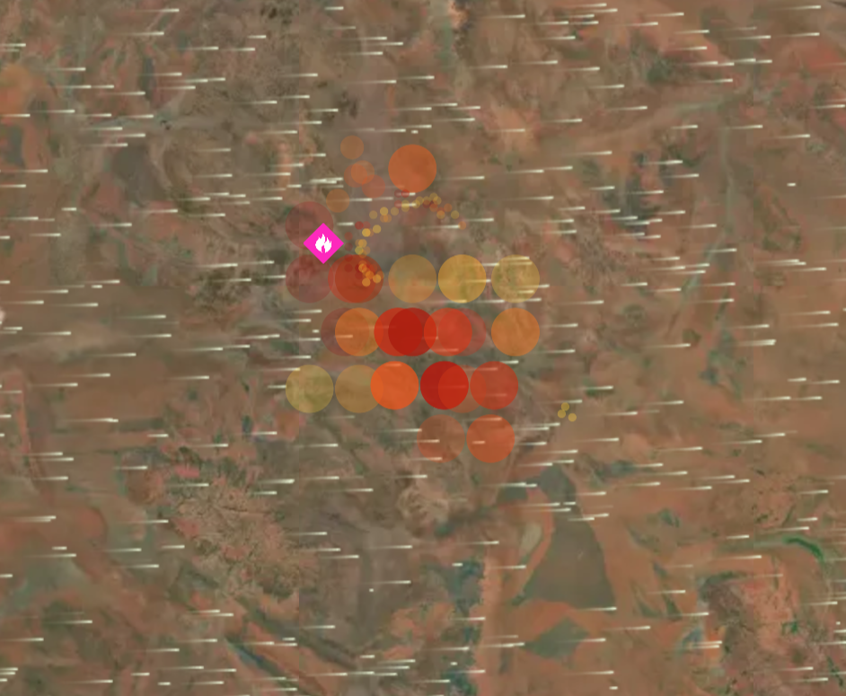
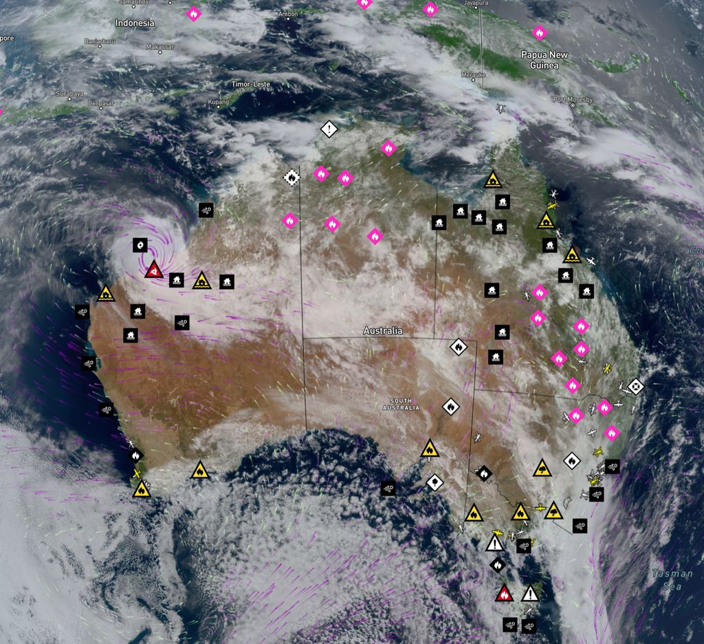
Instead of leaving users to sift through millions of lightning strikes and millions of hotspot detections per day, our platform does this work for you. The result? A small set of potential new fire ignitions that focuses on actionable insights. This integrated approach represents a significant leap in early fire identification. In the past 3 days alone, over 3 million lightning strikes occurred in Australia, and 100,000 hotspots were detected. We identified 17 possible fire ignitions—before any agency.
Stay Ahead with Real-Time Notifications
Beyond simply pinpointing new possible ignitions—and displaying them clearly on our map with full context—Bushfire.io also allows you to set up notifications for possible fires in your region. These proactive alerts can help farmers, landowners, managers, fire agencies, and businesses rapidly mobilise resources and mitigate damage the moment a threat is detected.
An Operational Milestone
Though research has explored combining lightning data with thermal hotspots for years, real-time, global-scale implementations outside the lab have been rare. Disaster Science’s Bushfire.io is one of the first platforms to bring these methods directly to end users, making advanced fire intelligence more accessible than ever.
Geostationary satellites like Himawari can detect new heat signatures as frequently as every 10–15 minutes, while sun-synchronous orbit satellites such as NOAA-20-21 and Suomi NPP—with their varying orbit intervals—help ensure rapid detection before a small spark becomes a larger threat
Technology Partners
- WeatherZone: We rely on WeatherZone for accurate, real-time lightning data, ensuring comprehensive coverage of potential ignition sources.
- Mapbox: Our visualisation partner, providing the advanced mapping capabilities that help users locate and track possible fires with ease.
Like with other amazing technology, we also stand on the shoulders of giants by utilising services provided by Geoscience Australia, OpenStreetMap, and Japan Meteorological Agency.
Try It Today
Possible Fire Ignitions is available now for Bushfire.io Pro and Bushfire.io Business subscribers. As we continue to refine and enhance the feature, we welcome feedback to help us deliver even more accurate and timely fire detection in the months ahead. Look for the pink fire icon!
To see it in action or to upgrade, visit Bushfire.io Pro or reach out to us at [email protected] if you would like to adopt this for your business or agency. You can also read our FAQ for more information.
About Disaster Science
Disaster Science is a disaster intelligence company dedicated to providing real-time data, alerts, and insights to individuals, businesses, and emergency services. Our flagship product, Bushfire.io, merges cutting-edge technology with an intuitive interface, empowering communities and organisations to respond faster and smarter when it matters most.